A custom interactive map I built at Other Tomorrows for the Emerald Necklace Conservancy, the historic chain of parks that runs through Boston, from Charlesgate through the Back Bay Fens, the Riverway, and Jamaica Pond to the Arnold Arboretum and Franklin Park. The client wanted visitors to read the eight parks as one connected system, and to explore any of them from their phone.
The core visuals, a system connecting Mapbox and Airtable, and a first build of the feature were established before I joined. My focus was the interaction layer. I made the user flow intuitive across mobile, tablet, and desktop, grounded in a universal set of rules and in close attention to how people behave and what they input on each device, so anyone can navigate the park maps freely.
How it works
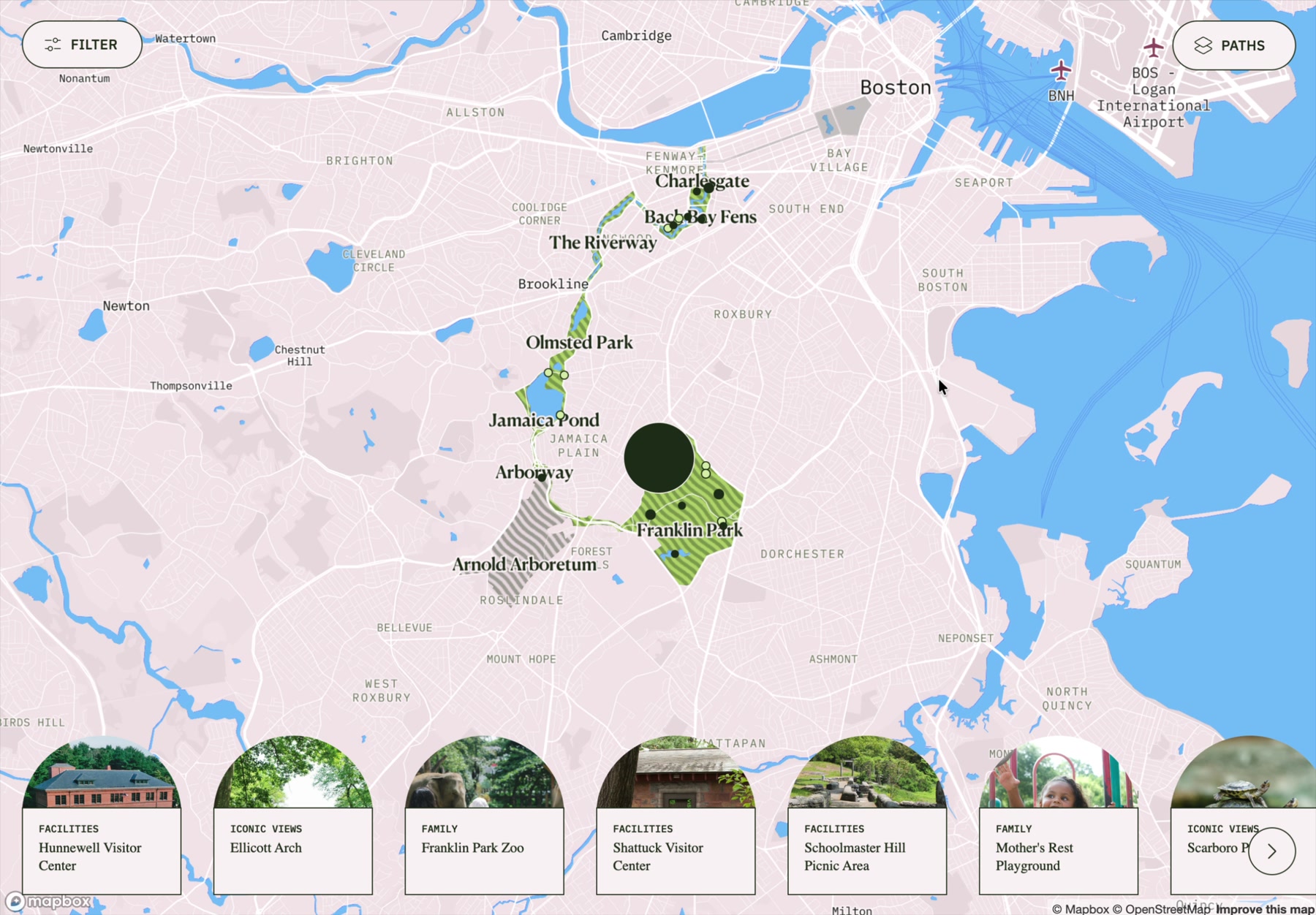
The map opens on the full necklace, so the whole system is visible at once. Panning and zooming moves across it, tapping a park focuses it, and tapping a point of interest opens the place. A focused park fills with green and its points of interest gather into a carousel along the bottom, so moving from the whole to a single park stays legible. Overlapping pins fan apart so none get buried, and the loading state reads finding a sun-basking painted turtle, one of the critters that actually live along the Necklace.
Opening a place
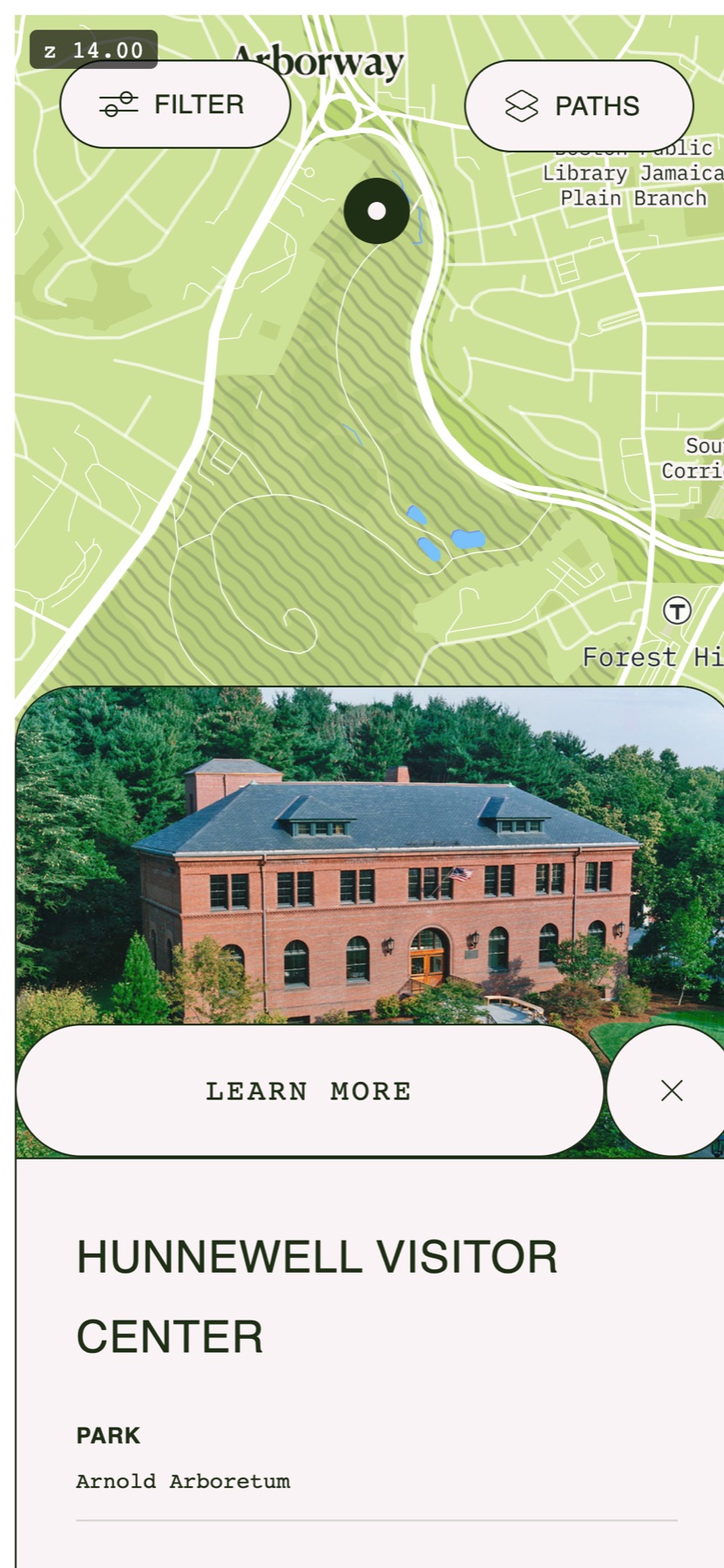
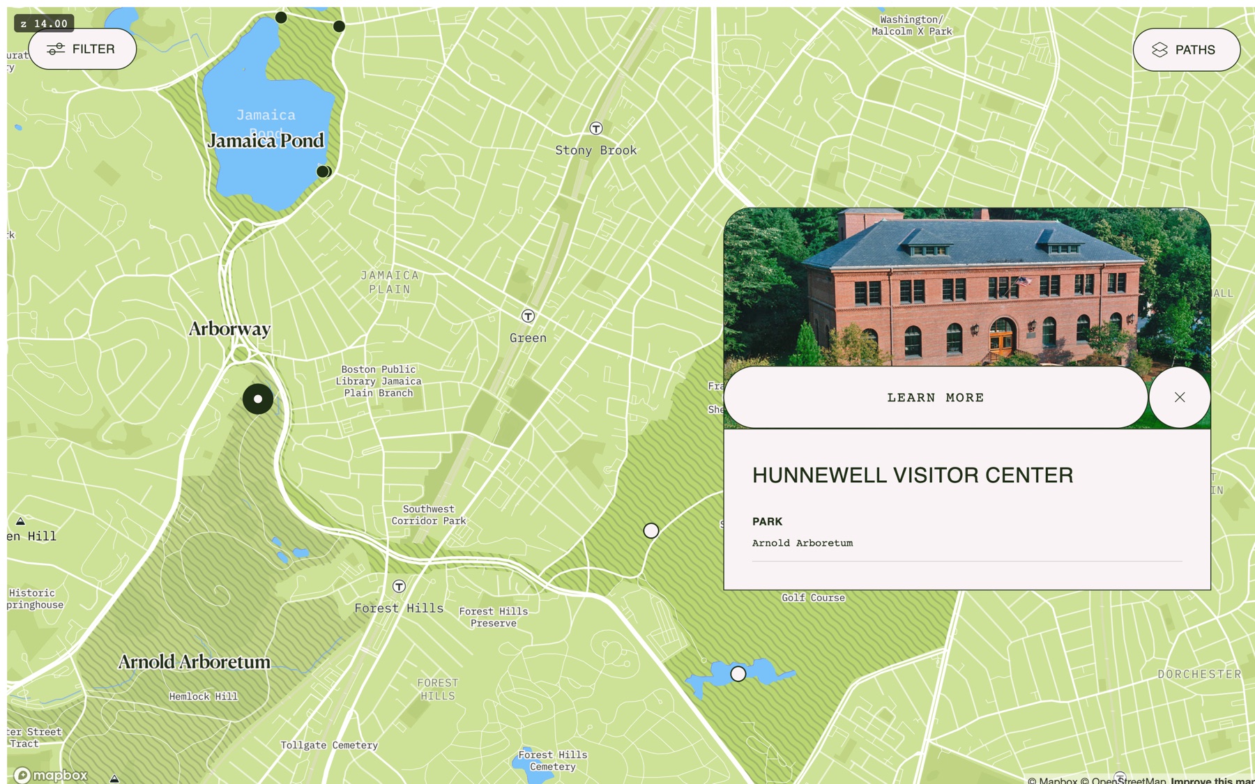
Opening a point of interest keeps it in context. On a phone it rises as a bottom sheet over the map; on desktop it floats as a card beside its pin. Both stay tied to the place they describe, with the photo, hours, accessibility, and story of the spot. A filter panel narrows the map by park, facility, or activity, so a specific interest can thin the field without ever losing the whole from view.
How it landed
What I care about most is that it stays genuinely fun to move through while landing the idea that matters most. The Emerald Necklace is a single, continuous system, not a scatter of parks. It is live for the Conservancy now, and the version here is my own.